What's in this roadmap
- Why the neighborhood decision outranks the city decision
- Start from your week, not from a wish list
- Map your actual weekly movements
- The commute is the cost everyone underestimates
- Pricing a neighborhood properly: rent plus movement
- The hourly wage of a longer commute
- Parking, the cost that hides in the lease
- The errand radius and what you will end up driving to
- Test the street at more than one hour and more than one day
- Transit frequency beats transit proximity
- Walkability is a property of the route, not the map score
- Groceries, pharmacy, and the everyday service layer
- Noise: flight paths, freight rail, and the sources that never move
- Water: flood history and the drainage you cannot see
- Signal, utilities, and the infrastructure checks people skip
- How to look up safety data without repeating a number out of context
- How to read school information from primary sources
- The in-person checks that no listing can give you
- Renting first as a hedge against incomplete information
- How the calculus changes with children
- Pets, and the neighborhood features that decide their day
- Remote work moves the weight to the neighborhood itself
- A worked example: two candidates, one household
- Scoring your shortlist without pretending it is science
- The mistakes that produce the regret
- The bottom line
Short answer: Choose a neighborhood by starting from the trips you actually make in a normal week, then pricing each candidate as rent plus the cost of moving around from it; in an illustrative comparison a $650 rent spread narrows to $340 once transport and parking are counted. Convert a longer commute into an hourly rate, test streets at more than one hour and day, and look up transit, noise, flood history and schools at the source.
Most relocation regret is not about the city. People research the city carefully, compare salaries and cost of living, weigh the job and the weather and the flight times, and then choose the neighborhood in an afternoon, from listings, in a place they have visited twice. Eighteen months later the complaint is never “wrong city.” It is the commute that turned out to be forty minutes worse than the map promised, the street that empties out after six, the grocery run that became a car trip, the freight line nobody mentioned because locals stopped hearing it years ago.
This roadmap is about the decision that gets the least attention and produces the most regret: which part of a city you actually live in. It starts from your real weekly movements rather than a wish list, prices each candidate as rent plus the cost of moving around from it, sets out the checks that are objective and the ones that need your own feet on the pavement, and shows how the whole calculation shifts with children, pets, or remote work. It sits alongside our roadmap on how to find an apartment, which handles the unit once the area is chosen, and our cost-of-living comparison roadmap, which handles the city. The salary calculator prices the income side while you read, and the companion below turns two candidate areas into a live comparison.
Key takeaways
- Start from the trips you actually make in a normal week, not from a list of desirable areas. The wish list describes who you would like to be; the trip map describes who you are.
- Price a neighborhood as rent plus movement. In an illustrative comparison, a $650 spread in rent narrows to $340 of total monthly cost once transport and parking are counted, and the cheapest rent finishes most expensive.
- Convert a longer commute into an hourly rate. Saving an illustrative $260 a month for eighteen extra hours of travel is roughly $14 an hour, before tax, for time you do not get back.
- Test at more than one hour and more than one day. A street at ten on a Sunday morning is a different street at seven on a Friday evening, and only one of them is the one you will live on.
- Research the objective layer from primary local sources: transit frequency, grocery and pharmacy access, fixed noise sources, flood history, signal. Look safety and school information up at the source rather than trusting a single score.
Why the neighborhood decision outranks the city decision
The city decision gets months because it feels enormous, and it is: it sets the salary, the tax picture, the climate, the distance to family. But the city decision is also the one with the most available information. Salary ranges are published, cost-of-living comparisons exist, and anybody who has lived there will tell you at length what the place is like. By the time you commit, you usually have a fair picture.
The neighborhood decision gets an afternoon, and it is the one made with almost no information. It is also the decision that determines what your ordinary Tuesday feels like: how long you spend getting to work, whether buying milk requires a car, whether you sleep through the night, whether you see anyone you know without planning it a week ahead. The city sets the range of your life. The neighborhood sets the daily texture of it, and the daily texture is what people quit over.
There is a second asymmetry. Getting the city wrong is expensive but obvious, and people fix it. Getting the neighborhood wrong is cheaper to fix and yet routinely goes unfixed for years, because a lease renews with one click and moving across town is a weekend of misery nobody schedules. The mistake is smaller and stickier, which is exactly why it deserves the research budget that currently goes to comparing metros.
Start from your week, not from a wish list
Ask anyone what they want in a neighborhood and you get a wish list: walkable, quiet, green, near good coffee, character, a bit of nightlife but not too much. Every item is real and none of them is a criterion, because they do not discriminate between candidates and they do not correspond to anything you can measure before you sign. Worse, wish lists describe an aspirational self. The person who lists nightlife often goes out twice a month; the person who lists green space last is the one walking a dog at six every morning.
The alternative is to start from evidence you already have. In a normal week, where do you actually go? Not where would you like to go: where do you go. That question turns a mood into a map, and the map is testable against a candidate area in a way that “walkable” never is. It also exposes the trips you had forgotten to count, which are usually the frequent, boring ones: the school run, the pharmacy, the parent you visit on Sundays, the appointment that repeats monthly.
Once the week is written down, the choice stops being a beauty contest between areas and becomes an arithmetic problem: which candidate makes the trips you genuinely repeat cheapest in time and money, and least dependent on things going right. That is a question you can answer before you move, which is more than can be said for “does this feel like me.”
Map your actual weekly movements
Do this properly and it takes twenty minutes. Take a normal week, not a holiday week, and list every trip out of the house with three columns: where, how often, and at what time. Work or school days go in first, then the recurring errands, then the social and health trips that repeat monthly rather than weekly. Include the trips other members of the household make, because a neighborhood that works for one adult and fails for the other is a neighborhood that gets renegotiated angrily in month four.
A typical week's trips, by purpose
Illustrative household, 28 trips out of the house in seven days.
Commuting is the single largest block but it is not the majority. In this illustrative week the non-commute trips outnumber it roughly two to one, which is why a neighborhood judged only on its commute gets judged on a third of the problem.
The chart shows the trap in both directions. Choose only on the commute and you have optimized about a third of your movement. Choose only on charm and you have optimized none of it. The list also gives you a natural weighting: a trip you make ten times a week deserves ten times the attention of one you make weekly, which sounds obvious and is almost never how people actually shortlist areas.
Keep the list. It becomes the scoring sheet later, and it is the only document in this process that describes you rather than the market.
The commute is the cost everyone underestimates
The commute is systematically underestimated for a structural reason: it is quoted as a best case and experienced as a distribution. A listing says twenty minutes to downtown. That number is a free-flowing off-peak drive with no incident, no weather, and no parking search at the far end. The number you live with is the ninetieth percentile, because a commute that is usually twenty five minutes and occasionally fifty is a commute you leave early for every day, which means you pay the fifty even on the days you get the twenty five.

Test it the only way that works: run the trip at the hour you would run it, in the direction you would run it, ideally more than once. A map app’s live estimate at the right time of day on a normal weekday is a reasonable substitute if you cannot be there, and its historical view is better than its optimistic default. Check the reverse direction too, since many corridors are ugly one way and fine the other, and check what happens when the primary route fails, because a neighborhood with one bridge, one tunnel, or one arterial is a neighborhood with a single point of failure.
Then price it twice. The commute costs money, which the next section handles, and it costs time, which is the currency people forget to convert.
Pricing a neighborhood properly: rent plus movement
The cheapest rent is rarely the cheapest neighborhood, and the mechanism is not mysterious. Land near the things people travel to costs more, so rent falls as you move outward and transport rises to meet it. The two curves cross somewhere, and where they cross depends on your own trip map rather than on the market’s average commuter. Comparing candidates on rent alone means comparing one column of a two-column problem.
The fix is to build a single monthly number for each candidate: rent, plus transit passes or fuel and tolls, plus parking, plus a realistic allowance for the errands you will now drive to rather than walk to. Insurance sometimes belongs there too, since premiums vary by where a vehicle is garaged. The rule is not that far is bad; it is that far is cheaper only by the amount left after movement is paid.
What movement costs each month, by candidate
Illustrative transport and parking for one household. Not quotes.
Illustrative rents across the same four candidates run $2,100, $1,900, $1,700 and $1,450, so a $650 spread in rent narrows to $340 in total monthly cost ($2,430, $2,290, $2,170 and $2,510), and the cheapest rent finishes as the most expensive place to live.
Notice the shape. The first three candidates trade rent for movement at roughly fair odds, and the total barely moves. The fourth crosses a threshold that matters more than distance: it requires a second vehicle. Thresholds like that, a second car, a paid parking space, a toll crossing, a fare zone boundary, produce the step changes that a smooth mental model of “farther equals cheaper” completely misses. Our roadmap on whether it is cheaper to live in the suburbs or the city works the same trade at metro scale.
The hourly wage of a longer commute
Money is only half of what a commute costs, and the other half is easier to ignore because nothing bills you for it. Convert it and the comparison sharpens immediately. Take the illustrative pair from above: the close-in candidate at $2,430 all in, the outer one at $2,170, a saving of $260 a month. Suppose the outer option adds twenty five minutes each way.
Twenty five minutes each way is fifty minutes a day, 250 minutes across a five-day week, and roughly eighteen hours a month once you account for a month being about 4.33 weeks. Over a year that is around 216 hours, or about nine full days. Divide the saving by the hours and the outer neighborhood is paying you approximately $14 an hour, before tax, to sit in transit or traffic.
That framing does not decide anything by itself, and it should not. Some people genuinely do not mind the trip, read on the train, or would take $14 an hour happily at this stage of their finances. The point is that the trade becomes visible and comparable to other choices, which it never is while it lives in your head as “a bit farther out but cheaper.” Run your own version in the companion below, and if the implied rate is well under what your time is worth to you, the cheaper rent is not cheap.
The other half of the honest accounting: commuting time is not neutral time. It arrives at the two hours of the day when you are least able to use it, and it is the first thing that erodes exercise, cooking, and seeing people, which are the things people cite when a move disappoints them.
Parking, the cost that hides in the lease
Parking is the most commonly missed line in a neighborhood budget because in some areas it is free and invisible and in others it is a second utility bill. The failure mode is assuming the rule you are used to. Somebody moving from a place with driveways prices a dense area as if a car simply sits outside; somebody moving the other way assumes the suburb includes a garage when the unit has one allocated space and a household with two vehicles.
Ask three specific questions of any candidate unit. What parking, if any, comes with the unit, and is it included in the rent or billed separately? If it is street parking, is a residential permit required, how much does it cost, how long is the waiting list, and how many permits per household are allowed? And what happens to a second vehicle, a visitor, or a delivery, since a place that works Monday to Friday and fails every time somebody visits is a place you will resent.
The same questions apply in reverse for people going car-free. If a candidate lets you drop a vehicle entirely, that is not a small saving, and it belongs in the comparison as its own line rather than buried in “transport.” Insurance, registration, maintenance, and depreciation are the invisible part of car ownership, and a neighborhood that removes them changes the total more than most rent differences do. Our true cost of relocating roadmap makes the same argument about the costs that never appear on a quote.
The errand radius and what you will end up driving to
The single best predictor of whether a neighborhood feels convenient is not its walk score, it is what sits inside a ten-minute radius of the front door on the routes you would really take. Write the errand list from the trip map, then check each one against each candidate: groceries for a full shop, groceries for a top-up, pharmacy, somewhere to post a parcel, somewhere to get coffee or sit down, a doctor, a hardware or general store, and whatever your household specifically needs weekly.

The check that matters is substitution, not presence. A neighborhood with a supermarket a nine-minute walk away and one with a supermarket a nine-minute drive away are not slightly different, they are structurally different, because the second turns an errand into a car trip, which means it gets batched, which means you buy differently, plan differently, and spend more. Count how many of your weekly errands convert from walk to drive in each candidate. That count predicts the fuel line in the budget and, more importantly, predicts how the place will feel on a day when you are tired.
One caution: opening hours and stocking matter as much as distance. A grocery that closes at six is not available to a household that gets home at half past. Check the hours, not just the pin on the map.
Test the street at more than one hour and more than one day
A street has several personalities and shows you one at a time. Ten on a Sunday morning is the flattering one: light traffic, no school run, nobody parked outside, whatever nightlife exists safely asleep. It is also the hour most people tour, because that is when viewings are scheduled, which means the majority of neighborhood decisions are made on the least representative sample available.
Build a testing plan instead of a visit. At minimum, see the street on a weekday at the hour you would leave in the morning, a weekday around six or seven in the evening, and once on a weekend night. Each window answers a different question: the morning shows the commute and the parking crunch, the evening shows whether the place has life or empties out, the weekend night shows noise and whether the walk from transit to the door is one you would make. If you can add a fourth, make it a wet or cold day, because weather reveals drainage, pavement quality, and how the street behaves when nobody wants to be outside.
Two shorter visits on different days beat one long one. A single day can be a street closure, an event, a bin collection, or a fluke of weather, and there is no way to know which from inside it. If distance means you truly get one visit, plan it to cross several windows and lean harder on the objective checks in the sections below, since those are the ones that can be done from a thousand miles away.
Transit frequency beats transit proximity
“Two blocks from the train” is the most oversold line in listings, and it is often true and nearly meaningless. A stop you can see from the window is worthless if the service runs every forty minutes, stops at ten at night, or does not run on Sundays. What determines whether transit is genuinely usable is frequency at the hours you would use it, plus reliability, plus whether it goes where your trip map says you go.
Look up the actual timetable for the specific stop rather than the line, since the same line can run every seven minutes on the trunk and every half hour on your branch. Check the first and last service, the weekend pattern, and whether there is any service at the hour you would come home from something social. Then check the interchange: a one-seat ride at moderate frequency usually beats a faster ride that requires a connection, because every transfer adds its own waiting distribution and its own failure mode.
The rule of thumb worth carrying: below roughly every ten to fifteen minutes, people stop treating a service as turn-up-and-go and start planning around a timetable, and a service you plan around competes very differently with driving. Also test the walk to the stop rather than the distance to it. Six hundred metres along a pleasant lit footway is nothing; the same distance along an unlit shoulder with no crossing is a walk you will do twice and then stop doing.
Walkability is a property of the route, not the map score
Walkability indices measure what is near, and what is near is only half of walkability. The other half is whether the route between here and there is one a person will actually use, and that is a property you can only assess by walking it. The classic failure is a shop three hundred metres away on the far side of a six-lane road with no signalised crossing for a kilometre. On a map it is next door. In practice it is a car trip.
Walk each of your top errands from the candidate address, once, in each candidate area. Note the things that decide whether a route gets used: continuous footway or none, crossings where you need them, lighting, gradient, whether the route passes anything that makes it pleasant or anything that makes it unpleasant, and how it behaves in rain. Note the surface too, because a route that works fine on foot can be impossible with a pushchair, a wheeled trolley, or a wheelchair, and those constraints do not announce themselves on a summer afternoon.
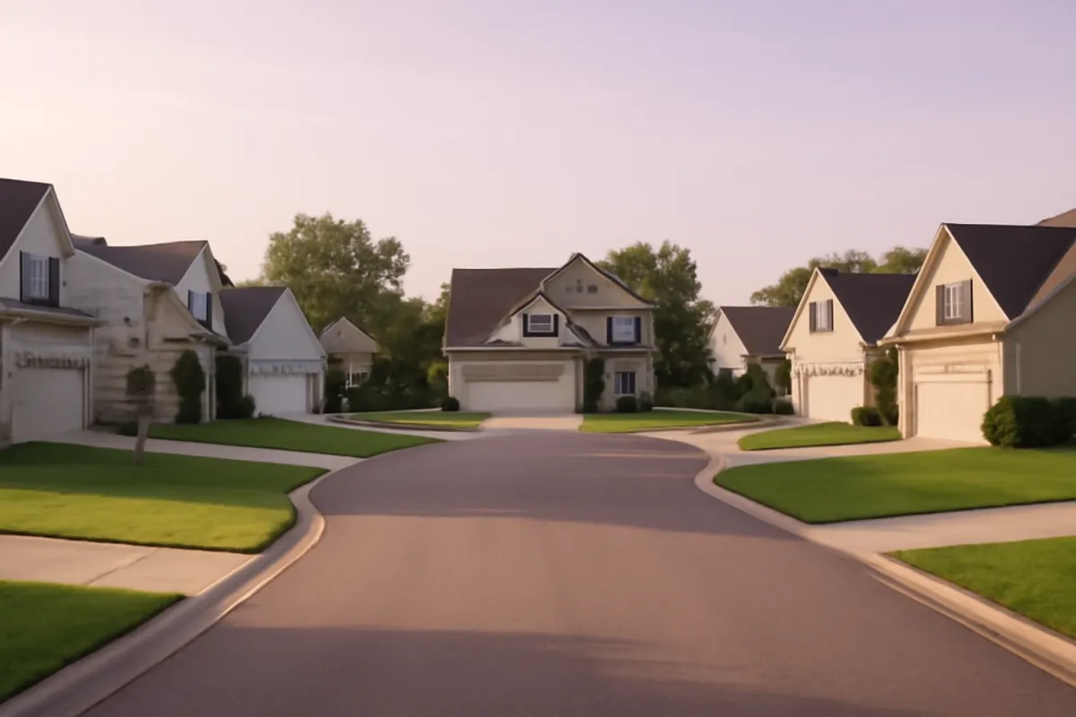
Street pattern deserves its own note. Layouts built around loops and cul-de-sacs produce short straight-line distances and long actual routes, because everything funnels to a few connector roads. A grid produces the opposite. This is why two addresses that look equidistant from the same shop can differ by a factor of two in walking time, and why the map’s straight-line reading is the least reliable input in the whole exercise.
Groceries, pharmacy, and the everyday service layer
Beneath the atmospheric stuff sits a service layer that decides whether ordinary life is friction or not, and it is worth checking explicitly because it is boring enough to skip. Groceries and a pharmacy lead the list, and both deserve more than a pin on a map: what are the hours, is there a full-range option or only convenience-store pricing, and if a household member takes regular medication, is there a pharmacy that can take a transferred prescription within a reasonable trip.
Then the rest of the layer, in rough order of how often people need it: primary healthcare accepting new patients, a dentist, urgent care and the nearest emergency department, a post or parcel point, laundry if the unit has none, a bank or credit union branch if you still need one, and childcare if that applies. Availability, not just existence, is the thing to check. In many areas a practice exists and is closed to new patients, which is a distinction that only shows up when you call and ask.
Delivery coverage is now part of this layer too, and it is uneven in ways that surprise people, especially at the edges of a metro and in buildings without a secure place to leave a parcel. Ask what actually gets delivered to the address rather than assuming the metro’s coverage applies uniformly across it.
Finally, note the redundancy. One grocery store is a single point of failure; two within reach means a closure, a renovation, or a change of ownership does not reorganise your week.
Noise: flight paths, freight rail, and the sources that never move
Noise is the complaint that turns a good unit into a bad one, and it splits into two kinds. Variable noise, neighbours, a bar, a busy weekend street, is real but can change, and sometimes it changes for the better. Fixed noise does not: a flight path, a freight line, a highway, an ambulance route to a hospital, a stadium, an industrial site with night operations. Fixed sources are also the ones locals stop mentioning, because human hearing habituates and they genuinely no longer notice.
The good news is that fixed sources are researchable from anywhere. Airport authorities commonly publish flight path and noise-contour information for their own operations, and many run public complaint or monitoring systems whose reports indicate which areas are affected. Rail alignments are visible on any map, and the question to ask is not whether the line exists but whether it carries freight, which typically runs at night and produces a different problem from passenger service. Major roads, hospitals, fire stations, schools, and venues are all findable before you ever visit.
Then verify on the ground. Stand outside the unit for five quiet minutes at more than one time of day, including once after dark, and listen rather than look. Inside, check what the windows are doing: whether the glazing is single or double, whether frames seal, and which rooms face the source. Ask the landlord or the current occupant directly what the noise situation is, and treat a vague answer as an answer.
Water: flood history and the drainage you cannot see
Flooding is the risk with the widest gap between how researchable it is and how often it gets researched. It is also the one where a single bad event costs more than every other neighborhood factor combined, and where the consequences follow you into insurance pricing and, if you eventually buy, resale.
Start with official flood hazard mapping for the address, which in the United States means the federal flood map service and any state or county mapping that supplements it, and elsewhere means the equivalent national or regional authority. Read those maps as zones of designated risk rather than as a promise, since mapping is updated on a schedule and does not capture every local drainage problem. Then supplement with local knowledge: municipal records or council minutes about drainage works, local news archives for past events, and the simple act of asking neighbours and the landlord whether the street or the basement has ever taken water.
Look at the land itself while you are there. Where does the ground slope, what is downhill of the unit, is the parking or storage below grade, does the street have working drains and are they clear, and are there watermarks on garage or basement walls. Ask what flood insurance would cost for the address, because the price quoted is itself a piece of information about risk, often a better one than the map alone.
Signal, utilities, and the infrastructure checks people skip
Some checks take two minutes and prevent a year of irritation. Phone signal is first: test it inside the unit, in the room you would work or sleep in, on the network you actually use, since coverage maps are modelled at street level and buildings with thick walls or metal cladding can be dead zones in a well-covered area. If more than one network is in the household, test both.
Internet is next, and the question is what is available at that address rather than in that area. Availability varies building by building, and in some buildings the choice has been made for you by a bulk arrangement with a single provider. Ask what service the current occupant has and what speeds they actually get, especially if anyone in the household works from home or takes video calls.
Then the utilities themselves: which heating and cooling system the unit uses and who pays for it, whether water and rubbish are included or billed, and what a typical month costs at that address, which a landlord or previous tenant can often tell you. Ask about power reliability if the area is prone to outages, and about water pressure on upper floors. None of these decides a neighborhood on its own. Together they decide whether the unit inside the neighborhood is livable, and they are the cheapest information in this entire process to collect. Our rent affordability roadmap shows why the billed-separately items matter to the monthly figure.
How to look up safety data without repeating a number out of context
Safety is where general articles do the most damage, because a number quoted without its context is worse than no number. So this section supplies a method rather than a figure, and the method starts with primary sources: the police department or law enforcement agency with jurisdiction over the specific area, and the city or county open-data portal if one exists. Many publish incident maps, periodic summaries, or the underlying records, which lets you look at a defined area over a defined period instead of at a headline.
Read the output carefully, because several things make raw comparisons misleading. Counts scale with how many people are present, so a busy commercial district with few residents will show numbers that say more about foot traffic than about risk to a resident. Reporting rates differ between places and between offence types, which means a difference in recorded incidents can be a difference in reporting. Boundaries rarely line up: a police beat, a census area, a postal code, and the neighborhood name locals use are four different shapes. And categories are defined differently by different agencies, so two cities’ figures are often not comparable at all.
Treat national ranking sites and single-score safety grades with particular suspicion, since they compress all of the above into one number without showing the inputs. Use the data as one input, pair it with walking the area at different hours, and ask specific questions locally: of the landlord, of neighbours, and of the non-emergency line if the department takes such calls.
How to read school information from primary sources
The school question deserves the same treatment, and the same refusal to quote numbers. Start with the attendance boundary, because it is what people get wrong most often. Districts publish boundary lookup tools that take an exact address, and neighborhood names have no authority over them: two units on the same street can be assigned to different schools. Confirm the assignment for the specific address you are considering, in writing if the decision hinges on it.
Then the school-level information, which comes from the state education agency’s report card or equivalent published data, and from the school itself. Read test-score summaries as one narrow measure with a well-known limitation: scores correlate heavily with the socioeconomic makeup of the student body, so they describe intake as much as instruction. Look instead at what the data can tell you honestly, such as enrolment trends, class sizes where published, programme availability, and how the school describes its own offering.
Two further cautions. Boundaries get redrawn, sometimes between the year you sign a lease and the year a child would enrol, so ask the district whether any boundary review is under way. And many districts run choice, magnet, or transfer programmes that change the assignment picture entirely, which is worth asking about before you pay a boundary premium in rent. Verify everything with the district, since policies change and no third-party summary is authoritative for your address.
The in-person checks that no listing can give you
Some things only a visit will tell you, and it helps to know in advance what you are going for so the visit is not spent admiring the kitchen. Sound is first: stand still and listen, inside and out, at more than one time. Smell is second and underrated, because industrial, agricultural, and waste-processing sources are strongly directional and seasonal and never appear in a listing. Light is third: which way does the unit face, what is being built next door, and does the room that looks bright at two in the afternoon get anything at nine in the morning.
Then the social read, done honestly and functionally. Are people out on the street at the hours you would be, is there anywhere that functions as a place to sit, are the shops occupied or shuttered, does the area look maintained. Those observations are legitimate and they are about the physical and commercial state of a place. Keep them there. Judging a neighborhood by who lives in it rather than by how it works is both wrong and a bad predictor: the functional checks in this roadmap are the ones that turn out to matter on a Tuesday in February.
Finally, talk to people. A neighbour on the step, a shopkeeper, someone walking a dog. Ask what they would change about living there, which gets more honest answers than asking whether they like it, and ask how long they have been there, since a street where people stay a long time is telling you something a listing cannot.
Renting first as a hedge against incomplete information
Everything above improves the quality of the decision without making it complete, because some things genuinely cannot be learned in advance. Which part of the city your friendships form in, whether the commute wears you down by month five, how the area handles its worst season: those take residence. That is the argument for renting first in an unfamiliar city, and it applies with more force to the neighborhood question than to the city question.
The asymmetry is the whole case. A lease is bounded: if the area disappoints, you lose some months and a move across town. A purchase in the wrong area costs transaction fees at both ends, another move, and whatever the market does in between, and it is the kind of mistake people live inside for years rather than fix. Our roadmap on renting first when relocating works through the staged version of this, and the same logic scales down to choosing between two rentals: prefer the shorter commitment when your information is thinnest.
Use the rental period deliberately rather than passively. Spend time in the areas you did not pick, notice where you actually end up on weekends, and keep a light note of what each month teaches. By the end of a year the decision usually makes itself, and it is frequently not the one the research picked, which is precisely the point of not committing irreversibly first.
How the calculus changes with children
Children change the weighting more than any other factor, mostly by adding trips and by making reliability matter more than speed. The school run is a fixed daily commitment at a fixed time, so a neighborhood is now being judged on two commutes rather than one, and they have to be compatible. A ten-minute saving on the adult commute is worthless if it makes the school drop-off impossible to reach on time.
Second, the errand load rises and the tolerance for friction falls. Trips get made with a child in tow, which converts marginal walking routes into impossible ones: a route with no crossing, a narrow footway, or a steep gradient is a route that becomes a car trip. Third, the informal infrastructure starts to matter, meaning playgrounds, libraries, pools, and clubs, and the practical question is whether they are reachable without an adult driving each time. Fourth, childcare availability is a real constraint with waiting lists in many places, and it is worth checking before the lease rather than after.
Finally, the time horizon lengthens. A household with children is more likely to want stability across several years, which raises the weight on things that change slowly, such as school boundaries, planned development nearby, and whether the housing type suits a family two years older than the one moving in.
Pets, and the neighborhood features that decide their day
Pets are a smaller adjustment than children but a specific one, and the features that matter are unglamorous. For dogs: is there a green space within a short walk, is it usable at the hours you would use it, are there footways to reach it, and what is the local rule on leads and off-lead areas. Access at six in the morning and nine at night is the real test, since those are the hours most dogs get walked and the hours lighting and safety of the route actually matter.
Then the constraints imposed by the building and the area. Many rentals restrict pets by size, number, or breed and charge deposits or monthly fees for them, and those terms vary enormously, so confirm them before falling in love with a unit. Ground-floor access, lift reliability, and somewhere to clean a wet animal are practical details that decide daily quality of life. Veterinary access matters too, including whether an emergency clinic exists within a sane drive at three in the morning, which is a question worth answering while you are calm.
Noise runs both directions here. A dog that barks is a neighbour problem in a building with thin walls, and a neighborhood with constant sirens or fireworks is a problem for an anxious animal. Our roadmap on moving with pets covers the transport side; the neighborhood side is mostly about routes, green space, and the terms in the lease.
Remote work moves the weight to the neighborhood itself
Remote work does not remove the method, it moves the weight. Delete or shrink the commute and the largest single item in the comparison shrinks with it, which genuinely widens the field of viable areas and is the honest reason many people can now consider places they could not before. But the same change means you will spend far more waking hours inside the neighborhood, so everything about the neighborhood at midday, which a commuter never experiences, moves up the list.
Test the daytime version specifically. What does the street sound like at eleven on a Tuesday, when the construction, deliveries, and leaf blowers happen? Is there anywhere within walking distance that works as a change of scene, since the failure mode of remote work is a household where nobody leaves the building? Do the errands work at the hours you would do them, which is one of remote work’s genuine advantages? And what does the connection actually deliver at the address, tested rather than advertised, along with a plan for what happens when it fails.
One more adjustment. Without a commute anchoring you, the trip map is dominated by social, errand, and health trips, so the weighting from earlier shifts hard toward the non-commute categories in the stackbar. Rebuild the map on that basis rather than reusing the commuter version, or you will optimise for a constraint you no longer have.
A worked example: two candidates, one household
Put the method together on illustrative numbers. A household is choosing between a close-in candidate and an outer one. The close-in unit rents at $2,100 a month, needs no car for the commute, and costs about $330 a month to move around from once a transit pass, occasional rideshares, and a paid parking space are counted. Total: $2,430. The commute is twenty minutes each way.
The outer unit rents at $1,700, includes parking, and costs about $470 a month in fuel, tolls, and the additional driving that errands now require. Total: $2,170. The commute is forty five minutes each way. On rent alone the outer unit looks $400 a month cheaper. On the honest total it is $260 cheaper, which is a real saving and worth having.
Now the time. Twenty five extra minutes each way is fifty minutes a day, 250 minutes a week, about eighteen hours a month, roughly 216 hours a year. The $260 saving divided by eighteen hours is close to $14 an hour, before tax. The household then asks the only question that matters: would we take a part-time job paying $14 an hour, at the two worst hours of the day, nine days’ worth a year, in exchange for that money? Some households say yes, especially if the money is doing something specific such as clearing debt or building a deposit. Others realise instantly that they would not.
Then apply the tie-breakers from the objective layer: transit frequency at the hours used, how many errands convert from walk to drive, fixed noise, flood history, signal. Run the same arithmetic on your own inputs in the companion, and price the income side against the city in the salary calculator.
Scoring your shortlist without pretending it is science
A scoring sheet is useful and it is not a model, so build it with that in mind. Take the trip map, list the criteria that came out of it, and weight them by frequency rather than by how strongly you feel about them: a daily trip outranks a monthly one even when the monthly one is more fun. Score each candidate out of five per criterion and multiply by the weight. Keep it to a single page.
The value is not the total, it is the disagreement. When the sheet says one thing and your gut says another, that is information: usually it means a criterion is missing or a weight is wrong, and finding out which is the actual work. Adjust the sheet until it explains your own preference, then check whether the adjusted version still favours the same candidate.
Two rules keep it honest. First, separate the things you can verify from the things you are guessing at, and mark the guesses, because a confident score on an unverified item is how a spreadsheet launders a hunch into a decision. Second, apply a veto list rather than trying to price everything: some things, an impossible school run, a flood-prone basement, a commute over a threshold you know you cannot sustain, should eliminate a candidate outright rather than lose points. Weighted averages are bad at deal-breakers, and deal-breakers are what produce regret.
The mistakes that produce the regret
Almost all neighborhood regret traces back to a short list of errors. The first is touring only at the flattering hour, which is the default because it is when viewings happen. The second is pricing on rent alone, which reliably picks the wrong candidate in exactly the cases where the difference is large enough to matter. The third is trusting the optimistic commute figure instead of the bad-day one.
The fourth is choosing for an aspirational life rather than the actual week, which is how people end up paying a premium for nightlife they attend twice a year and no premium for the grocery trip they make three times a week. The fifth is treating a single score, whether a safety grade, a school rating, or a walkability number, as a verdict rather than as one compressed input with its methodology hidden. The sixth is ignoring thresholds: the second car, the permit waiting list, the toll, the fare zone, each of which produces a step change no smooth mental model catches.
The seventh is committing irreversibly on incomplete information, which is the one that turns a fixable mistake into an expensive one. And the eighth, quietly common, is deciding alone in a household of two, which produces a neighborhood that satisfies whoever did the research and gets renegotiated later at some cost. Run the trip map for everyone who lives there, and the sheet stops being one person’s argument.
The bottom line
Choosing a neighborhood well is not a matter of taste, it is a matter of doing arithmetic that most people skip. Write down the week you actually live, price each candidate as rent plus the cost of moving around from it, convert the commute difference into an hourly rate and decide whether you would take that wage, then work the objective layer: transit frequency at your hours, errands that stay walkable, fixed noise, flood history, signal, and safety and school information read from primary local sources rather than from a single score. Visit at more than one hour and more than one day, keep the commitment short while your information is thin, and let the household’s real movements settle the argument. The salary calculator prices the income side, our roadmap on finding an apartment handles the unit once the area is chosen, and the neighborhood decision, given the twenty minutes of honest listing it deserves, stops being the thing you regret.
ReloPeak publishes this roadmap for general education, not as financial, legal, real-estate, or safety advice, and nothing here is a recommendation about any specific address, area, school, or property. Every rent, transport cost, commute time, and hourly figure in it is illustrative, chosen so the arithmetic is easy to follow rather than to describe any real market. Deliberately, no crime, school, price, or flood statistics are quoted: those figures depend entirely on local definitions, boundaries, and reporting periods, and repeating one out of context is how a decision goes wrong. Look them up yourself from the police department, education agency, and flood-mapping authority with jurisdiction over the exact address, confirm lease and permit terms with the landlord and the local authority, and bring a qualified professional into anything with money at stake.
Frequently asked questions
How do I choose a neighborhood before I move there?
Start from your own week rather than from a list of desirable areas. Write down every trip you actually make in a normal seven days, work, school or childcare, groceries, the gym, medical appointments, the people you see, and then test each candidate area against that map instead of against a general reputation. Price each candidate as rent plus the cost of moving around from it, since the cheaper rent often sits where the transport bill is higher. Then visit the finalists at more than one hour and on more than one day, because a street at ten on a Sunday morning tells you almost nothing about the same street on a Friday night or a Tuesday at seven.
What should I look for in a neighborhood?
Weigh the things that are objective and repeatable ahead of the things that are atmospheric. How often transit actually runs at the hours you would use it, not just how close the line is; whether groceries and a pharmacy are reachable on the route you would really take; whether the walk is a walk or a shoulder of a road; what the fixed noise sources are, such as a flight path, a freight line, or an arterial road; whether the block has a flood history; and whether phone signal works inside the unit. Those checks either pass or fail and they do not change with your mood on the tour day. Charm is real, but it is the part of a neighborhood you can assess in an afternoon, so spend your scarce research time on the parts you cannot.
How much does the commute really matter when picking a neighborhood?
More than almost anything else, because it is paid twice daily and in two currencies at once. An illustrative example: a closer area at $2,100 rent with $330 a month of transport and parking totals $2,430, while a farther one at $1,700 rent with $470 of movement totals $2,170, so the farther option saves about $260 a month. If it also adds twenty five minutes each way, that is roughly eighteen extra hours a month of travel, which works out near $14 an hour before tax for time you cannot reclaim. Those numbers are illustrative rather than a quote for any market, but the method is the point: convert the saving into an hourly rate and decide whether you would take that job.
How do I check whether a neighborhood is safe?
Look it up from primary local sources rather than from a national ranking site or a comment thread. Most police departments publish incident maps or periodic reports for their own jurisdiction, and many city open-data portals publish the underlying records, which lets you look at a specific area over a specific period rather than at a single headline figure. Read those numbers carefully: raw counts rise with population and with how much foot traffic an area gets, reporting rates differ between places, and boundaries used by one source rarely match the boundaries used by another. Treat the data as one input alongside walking the area yourself at different hours, and be wary of any source that reduces a neighborhood to a single score without showing you what went into it.
How should I research schools for a neighborhood?
Go to the primary sources: the district's own attendance-boundary tool for the exact address, the state education agency's report card for the school, and the school's own calendar and enrollment information. Boundaries are the part people get wrong most often, because they do not follow neighborhood names and they can be redrawn between the year you move in and the year your child would start. Read test-score summaries as one narrow measure that correlates heavily with the makeup of the student body rather than as a verdict on teaching quality, and pair them with a visit, the transport question, and whatever transfer or choice options the district runs. Confirm everything with the district itself, since policies change and no third-party summary is authoritative.
Should I rent first before committing to a neighborhood?
In an unfamiliar city, renting first is usually the cheaper way to be wrong. Buying commits you to a specific block based on information you have not had time to gather, and unwinding that decision costs transaction fees on both ends plus another move. A lease is bounded and reversible, and a year in an area teaches you things no amount of research does, including which part of the city your life actually gravitates toward. Our roadmap on renting first when relocating works through the sequencing, and it applies even more strongly to the neighborhood question than to the city question, because the within-city choice is the one made with the least information.
How long should I spend testing a neighborhood before signing a lease?
If you can only manage one visit, plan it to cover several different windows rather than one long block: a weekday morning at the hour you would leave, a weekday evening around six or seven, and a weekend night. Two visits on different days is better than one long day, because a single day can be a fluke of weather, a street closure, or an event. If you are moving from far away and can only see the place once, weight the objective checks more heavily, since transit timetables, grocery access, flood history, and noise sources can all be researched from a distance, while atmosphere cannot.
Does remote work change how I should choose a neighborhood?
It changes the weighting rather than the method. Without a daily commute, the largest single cost in the comparison shrinks, which frees you to buy on other criteria, but it also means you will spend far more waking hours inside the neighborhood itself, so daytime noise, the quality of nearby third places, walkable errands, and reliable internet and phone signal all move up the list. Test the things a commuter never notices: what the street sounds like at eleven on a Tuesday morning, whether anywhere nearby is usable as a change of scene, and how the connection performs at the hours you would be on calls. Ask about the actual service available at the address rather than assuming the area's advertised options apply to every unit in it.